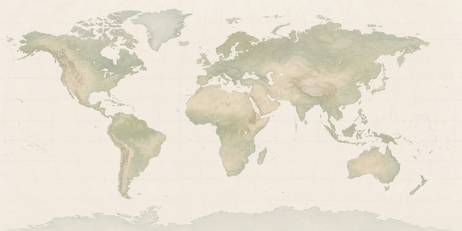
See your land clearly
Aerial maps, contour lines, and 3D models of your property, delivered as files you can open, share, and keep.
Serving landowners, buyers, and contractors across Tifton and South Georgia.
FAA Part 107 certified · Locally owned in Tifton, GA
See the land.
Understand the details.
We turn aerial imagery, GNSS field observations, and site photographs into clear, organized property documentation. From existing site conditions to interactive GIS references, our work helps landowners see the bigger picture and share useful information.
Mapping and documentation,
made practical.
Clear maps and visuals to help you understand, document, and discuss your property.
Property Feature Mapping
Wells, gates, cameras, visible electrical equipment, water access, and other agreed features, organized on a layered GIS map. You receive a finished map plus KML/KMZ files that open in Google Earth. Underground information is recorded as owner-reported.
Aerial Mapping & Imagery
A high-resolution overhead view of your property, useful for planning, sharing, and keeping a record of visible conditions. Coverage is agreed before work begins.
Contour & Terrain Maps
Understand terrain shape, high and low areas, and potential drainage patterns. Useful visual references for discussions about drainage, ponds, and site planning.
3D Site Models
Rotate and zoom around a visual model of your property from your phone or computer, where suitable imagery supports a model.
Additional support includes aerial photo and video documentation, site evaluation, visual project planning, and repeat documentation where applicable. All reference mapping is for information and documentation, not a licensed land survey.
See what organized site information looks like.
Explore aerial imagery, contour mapping, and an interactive feature inventory. Examples are presented without property names or map coordinates.
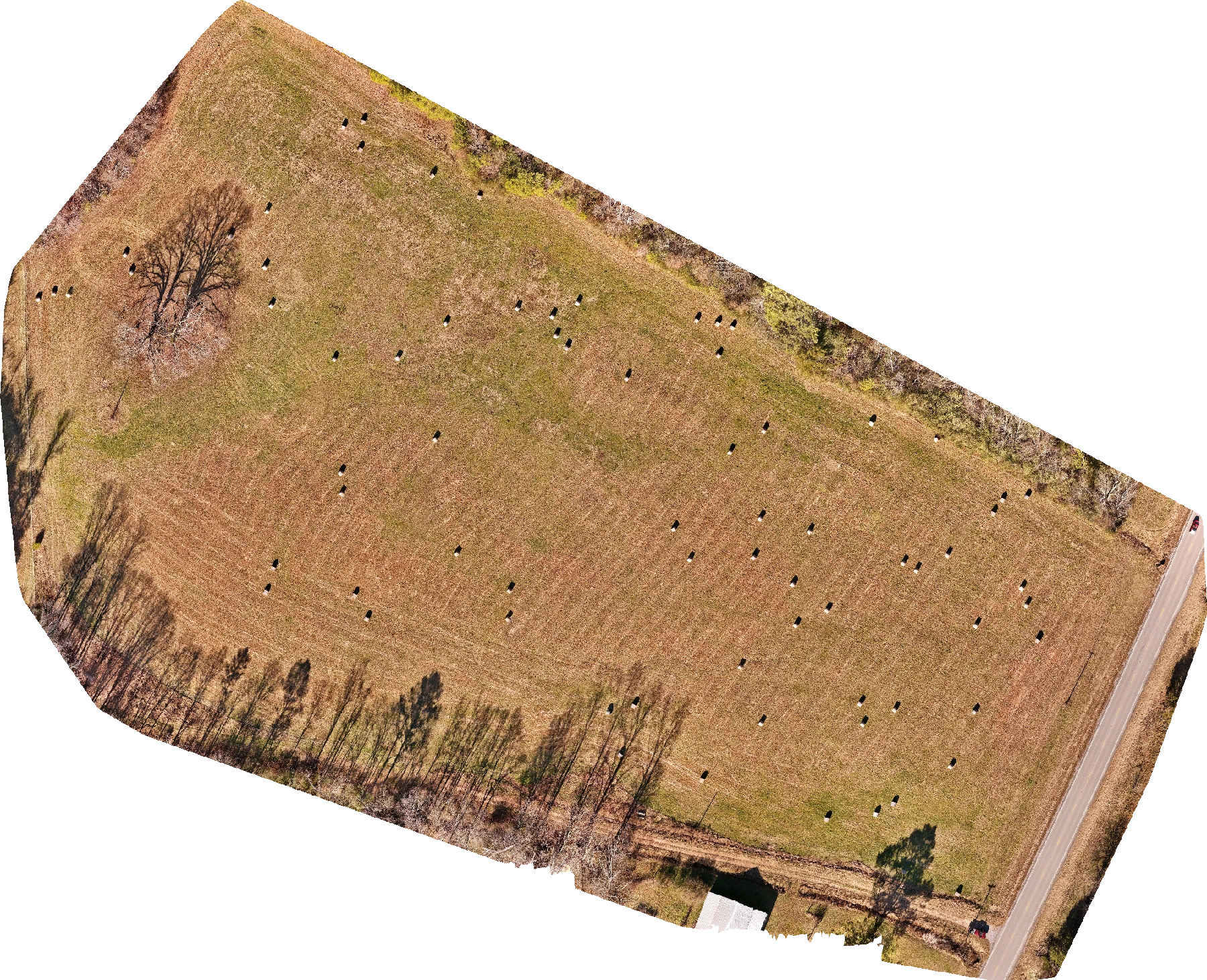
Aerial Site Documentation
A completed orthophoto presents a continuous overhead view, bringing visible site conditions into one clear image.
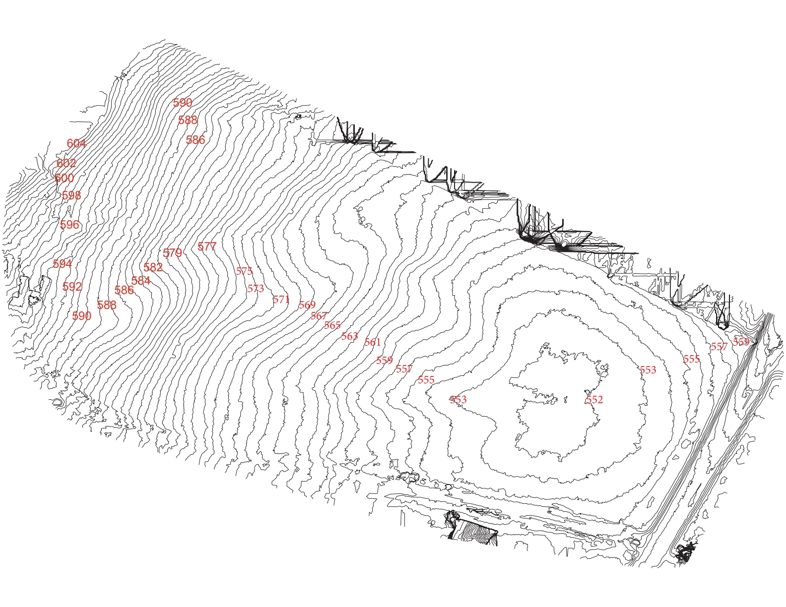
Terrain & Contour Mapping
Contour linework makes changes in terrain shape easier to interpret and provides a clear visual reference for site discussions.
Property Feature Mapping
Explore water access, electrical equipment, cameras, and other documented features in one interactive example.
Visual documentation examples for reference and discussion. The interactive demonstration uses an invented site; these examples do not establish legal boundaries or certify elevations.
More than a collection of photographs.
We bring site information into practical formats you can keep, view, and share. The deliverables are selected around the property’s needs. Included outputs, formats, software compatibility, viewing-link access, and availability periods are agreed in the quote. Each service includes its agreed outputs.
- Organized aerial imagery and photo records
- GIS layers identifying documented site features
- For property-feature mapping: a finished map and underlying data files
- Google Earth-compatible KML/KMZ is standard for property-feature maps
- For agreed 3D work: a phone-friendly viewing link and downloadable model file
Exploring possible pond locations
A landowner wanted to understand how water moved across a field and explore possible pond locations. Practical Land Services provided aerial photos and a contour map, then walked through the results with the customer to discuss potential locations and support their planning.
This example is reproduced from a supplied contour map. Source elevation labels are retained for illustration; units, vertical reference, and accuracy must be confirmed before measurement or design use.
See a site from a different angle.
Explore two examples of photogrammetry-based site documentation. Rotate the view and zoom in to see the shape and visible features of each site.
Examples use neutral labels and local model coordinates. These visual demonstrations are not boundary surveys or measurement tools.
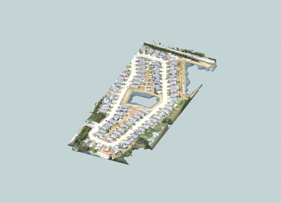
Example 01 · textured site preview
Drag to rotate · scroll or pinch to zoom · arrow keys to orbit. On phones, swipe vertically to keep scrolling.
Enable JavaScript for interactive viewing. The static preview remains available.
Clear from start to finish.
Talk
Tell us what you want to know about your land.
Capture
We collect aerial imagery and ground observations appropriate to your project.
Deliver
You get organized maps, imagery, and files you can keep, according to the agreed scope.
Good information makes better decisions.
A few quick answers before we discuss your project.
Is this a land survey?
No. We document visible features and referenced observations. Our maps do not establish legal property boundaries or replace a licensed land survey.
What will I receive, and how do I open it?
Property-feature maps include a finished map, underlying data, and Google Earth-compatible KML/KMZ files you can open in Google Earth. Your agreed job may include organized imagery or a downloadable 3D model with a phone-friendly viewing link. Included formats, software compatibility, link access, and availability periods are agreed in your quote.
Where do you work?
We serve Tifton and South Georgia. Other locations are considered individually.
What affects the price?
Property size, site access, the detail requested, and the deliverables affect your quote. We discuss the scope with you before pricing the work.
How long will my project take?
Timing is agreed for each job and depends on weather, site access, and processing needs. We discuss the expected schedule when defining your project.
Use of project documentation
Our maps and models document visible site conditions for reference and planning. They are not a land survey and do not establish legal boundaries or certified elevations. Please consult a licensed surveyor or engineer before construction, excavation, or legal decisions.
Project tools and development previews.
Use Client sign-in for project files and updates, or Employee sign-in for company-assigned work. The separate drone marketplace is a restricted development preview.
Client sign-in
One place for your project updates, maps, photos, 3D models, and downloadable files.
Customer portal preview · Private files require client sign-inEmployee sign-in
Company-assigned jobs and field checklists for Practical Land Services staff.
Employee portal · Company access requiredFind a Drone Pilot
Job posting and pilot quote tools are being developed here. Public job posting and hiring are not open yet.
Private development preview · Owner access onlyReady to see your property clearly?
Tell us about your land and we’ll recommend an approach and explain the available deliverables.
Request a Quote
practical.land.services@gmail.com
Prepare an email quote request
This website prepares your request for email. It does not submit an online enquiry. Review the details, then send them from your email app to practical.land.services@gmail.com.
Details stay on this page unless you choose browser-tab saving, open your email app, copy or download them. This form does not submit your request to a website server. Browser-tab saving is optional and off by default. Your browser or email app may retain details. Without browser-tab saving, refreshing or closing this page discards the form; copy or download your request before leaving. Browser recovery is not a backup. Attach photos in your email app; this page does not upload files.
Continue an unfinished request
Optional: save a draft in this browser tab and restore it within 24 hours of its last save. It is not sent to us. Avoid this option on a shared device. Closing the tab usually removes it, but browser session recovery may retain it.
Review your email request
Nothing has been submitted. Check the details below. To request a quote, send the email yourself.
This request is longer than some email apps can open reliably. Copy or download the complete request and email it to practical.land.services@gmail.com. No details have been shortened.
If your email app does not open, use Copy request or Download request text. Send it to practical.land.services@gmail.com. Attach any photos there. Your request reaches us only after you send the email.